SCAN TO BIM
SOLUTIONS FOR
YOUR AS-BUILT SURVEYS
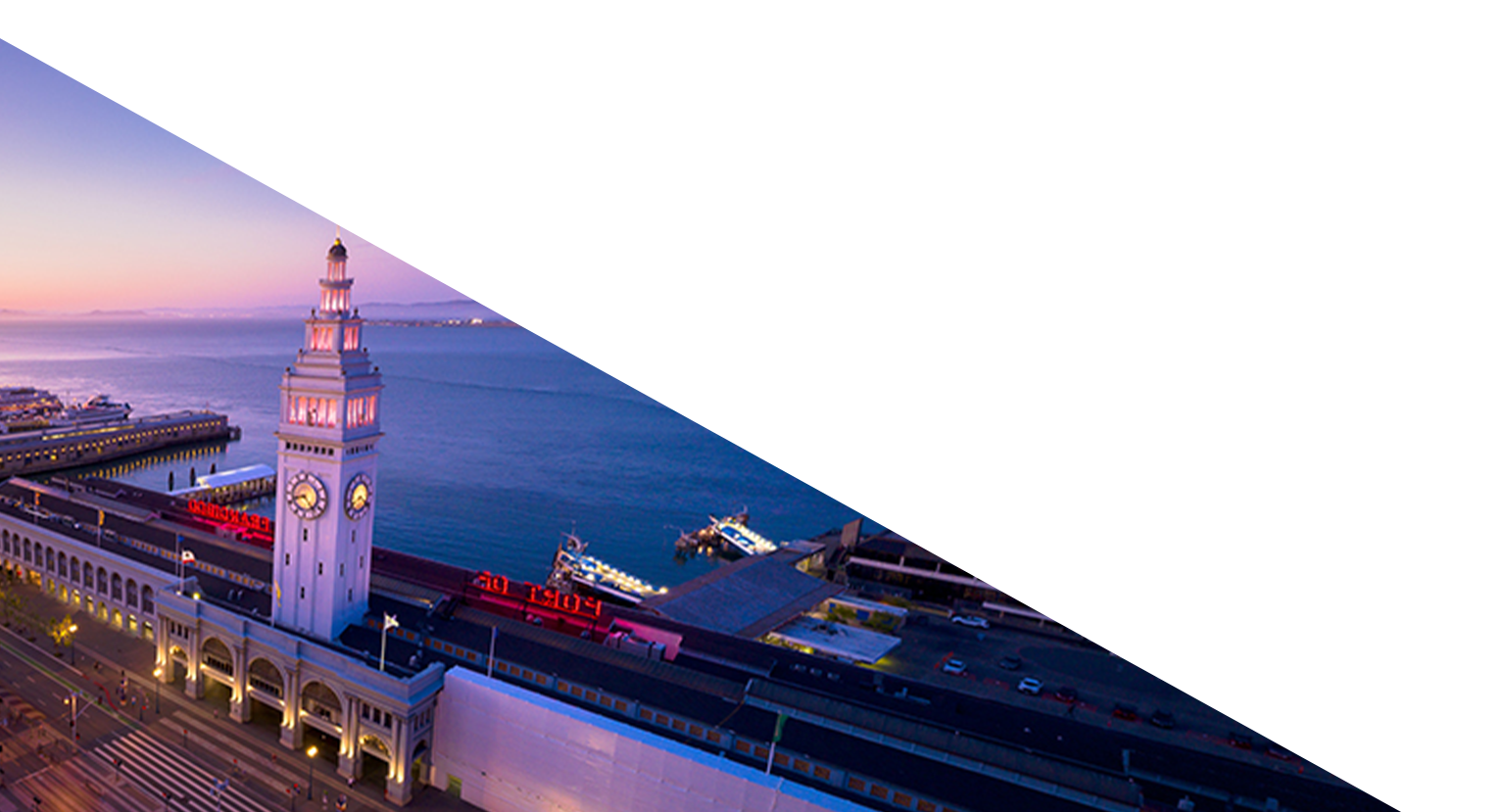
AEC | HISTORIC PRESERVATION
YOUR AS-BUILT SURVEYS
AEC | HISTORIC PRESERVATION
Contact us today. We look forward to starting a conversation about your project.
In today’s fast-paced construction and meticulous preservation environments, inaccurate or incomplete building data is a liability. It leads to costly change orders, project delays, and compromises the integrity of your vision. 3DVDT bridges the critical gap between the physical world and your digital design plans. Leveraging 13 years of specialized experience and advanced 3D laser scanning technology, we capture every detail of your site with unparalleled accuracy. The result is a complete, reliable digital representation—from a single point cloud to a comprehensive Scan-to-BIM model—that forms the foundation for confident decision-making and project success.
We apply our full suite of reality capture services to solve the distinct challenges of your industry. Our experience means we don’t just deliver data; we deliver solutions that integrate seamlessly into your existing workflows, whether you’re coordinating a complex construction project or documenting a priceless cultural asset.
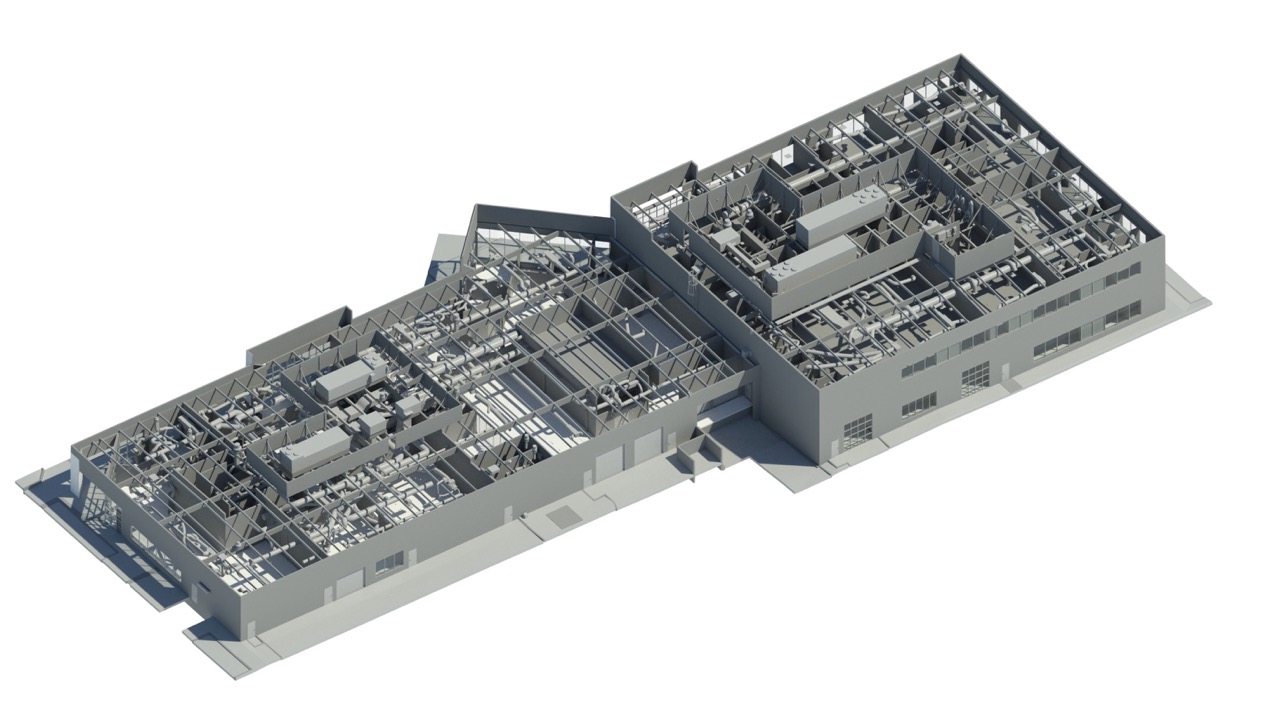
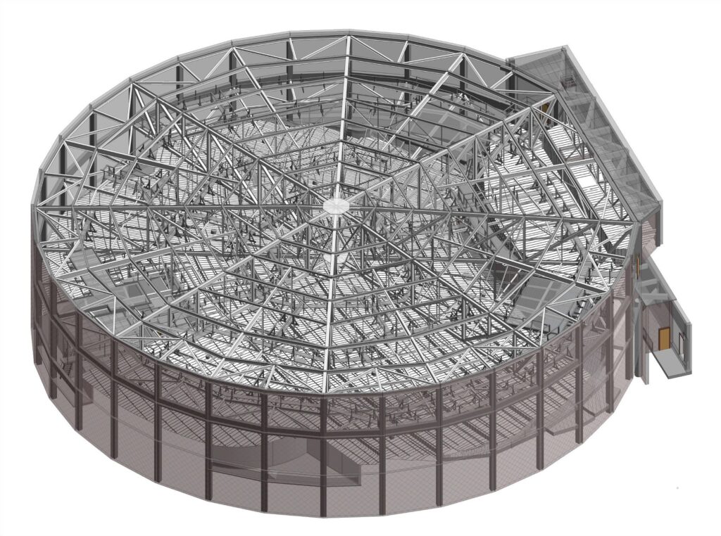
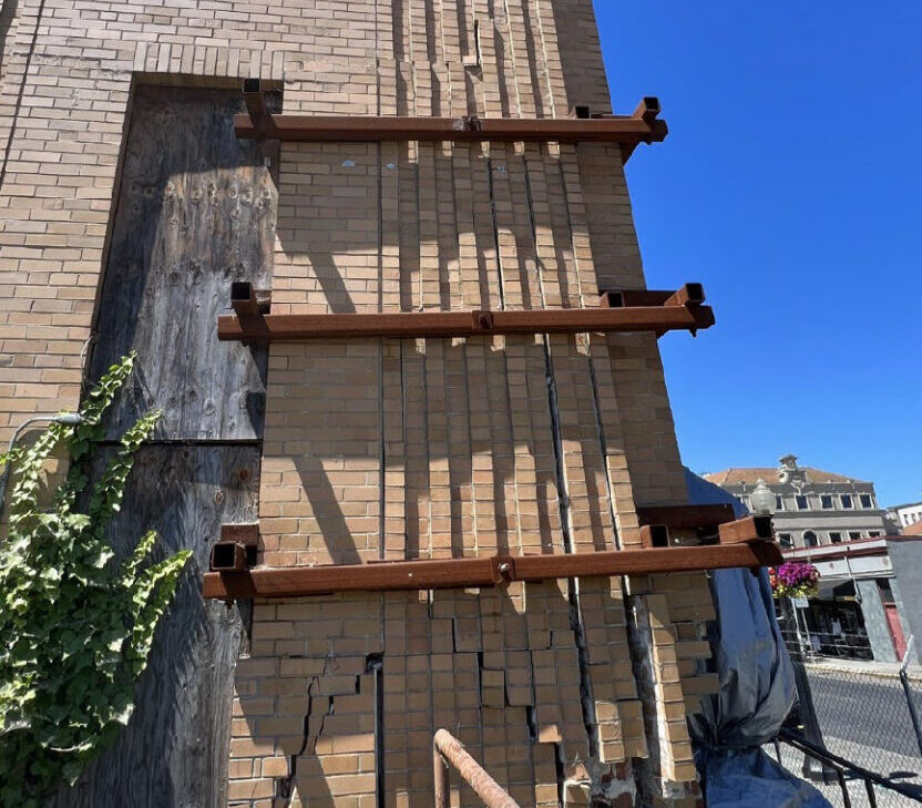
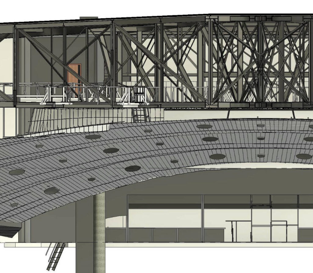
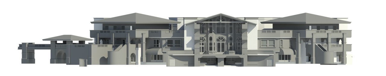
For AEC professionals, certainty is currency. Our services are engineered to mitigate risk and enhance efficiency from design through completion. We provide the precise as-built documentation needed for renovation projects, preventing clashes between new designs and existing structures. This is a critical first step, as outdated plans are a primary source of costly rework. Our Scan-to-BIM services create an intelligent model that serves as the project’s single source of truth, improving BIM coordination among all trades and drastically reducing the need for change orders. We help you build better, faster, and with greater confidence.
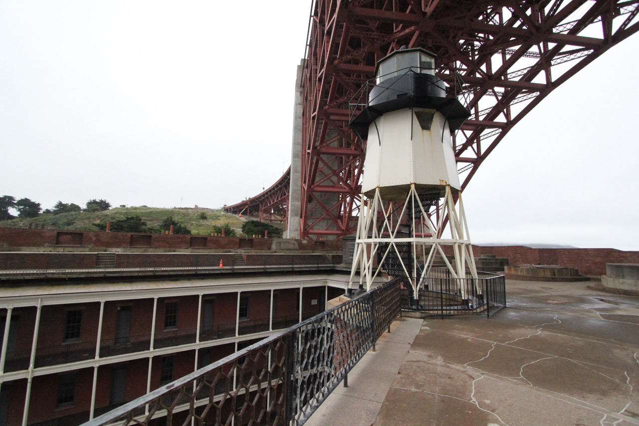
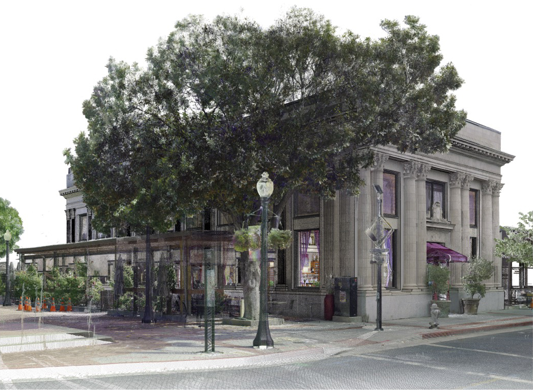
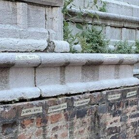
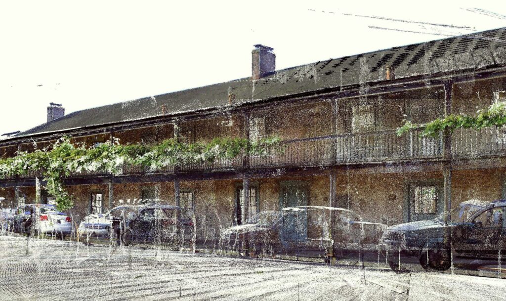
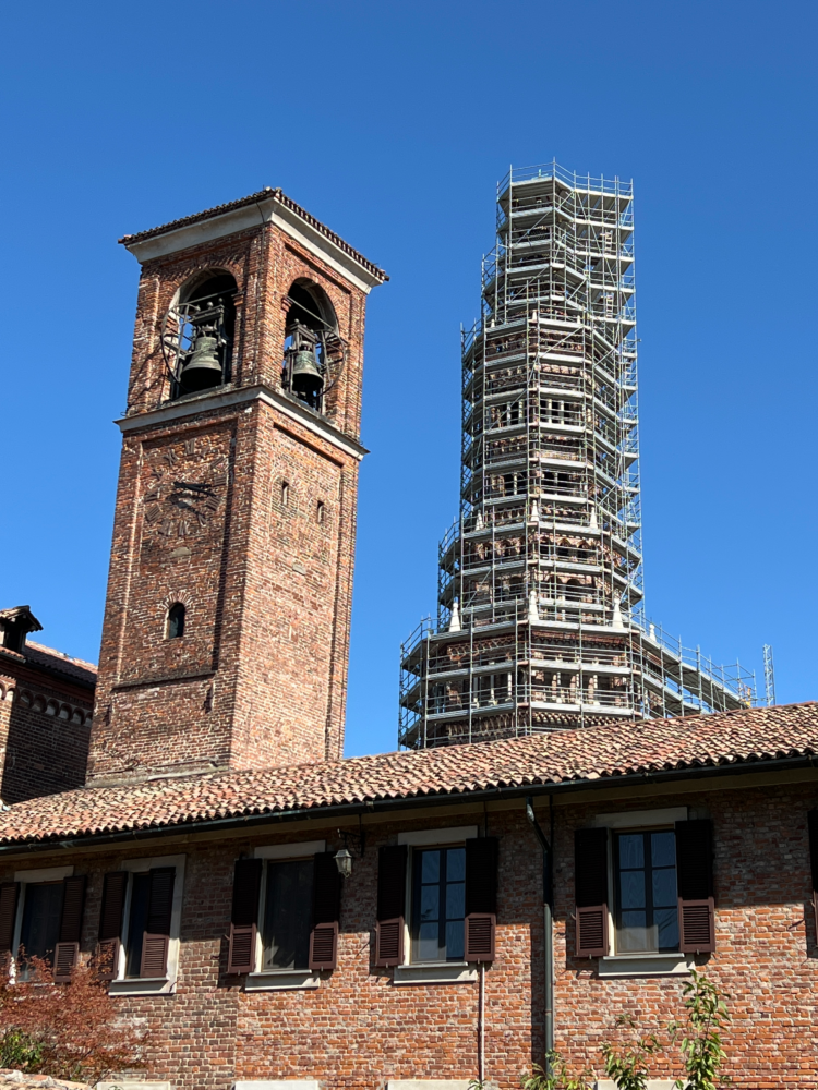
Documenting our shared heritage requires a unique blend of technological precision and profound respect. Our non-invasive 3D laser scanning techniques capture every detail of a historic site without physical contact, preserving its delicate materials. We are experts in producing documentation that adheres to the Secretary of the Interior’s Standards for HABS/HAER/HALS, creating a permanent, invaluable record for archivists and preservationists. This specialized service is often a required mitigation step for projects affecting historic properties. From Heritage BIM (HBIM) models for restoration planning to detailed measured drawings, we provide the expertise to navigate federal archival standards and help safeguard history for future generations.
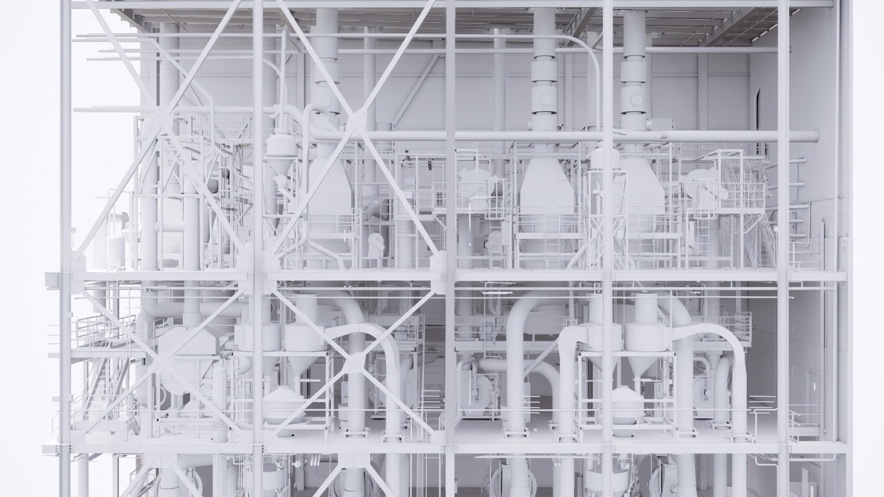
In dynamic industrial environments, accurate spatial data is essential for safety, efficiency, and quality control. Our 3D scanning services support facility management by creating accurate digital twins of complex plants and equipment, which is vital when original drawings are missing or outdated. This enables more effective planning for retrofits and equipment placement, preventing costly shutdowns. For manufacturing, our technology is invaluable for quality assurance and reverse engineering. We can scan a physical part and compare it to a 3D model to verify tolerances or create a new design from an existing object without original plans, accelerating product design and development.
3DVDT has years of experience servicing clients to expertly handle just about any project: from tenant improvement, hospitality, event production, City improvements to home remodel, we are always ready to assist you with a solution tailored to your project’s needs.
Turning a physical object or an entire building into a precise digital model is a meticulous process. We combine cutting-edge technology with a proven, collaborative workflow to ensure the final deliverable meets your exact specifications and exceeds your expectations. This transparent process ensures that from the first conversation to the final handover, you are partnered with a reliable team committed to excellence.
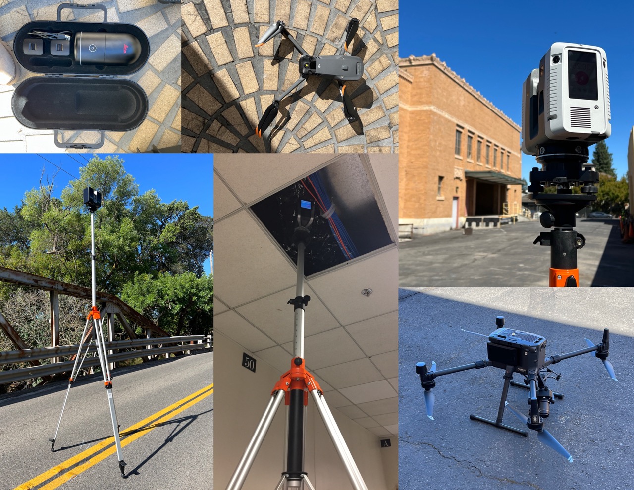
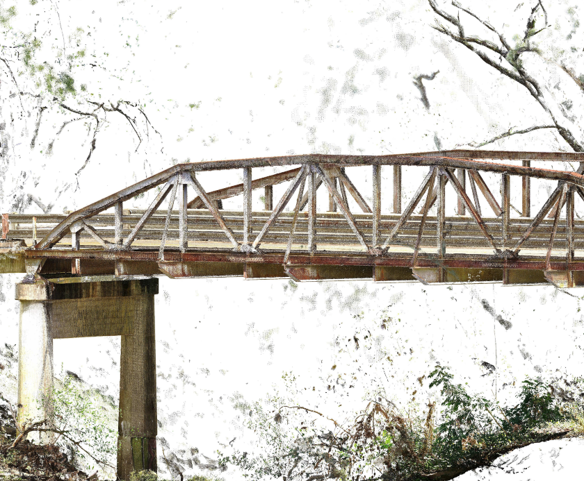
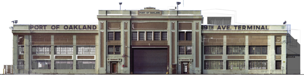
The workhorse of our operations. These high-accuracy laser scanners sit on a tripod and rotate 360 degrees, capturing millions of data points to create a dense, precise point cloud. This technology is ideal for capturing the existing conditions of buildings, facilities, and complex sites with a typical accuracy of just a few millimeters, providing the foundation for all subsequent design and analysis.
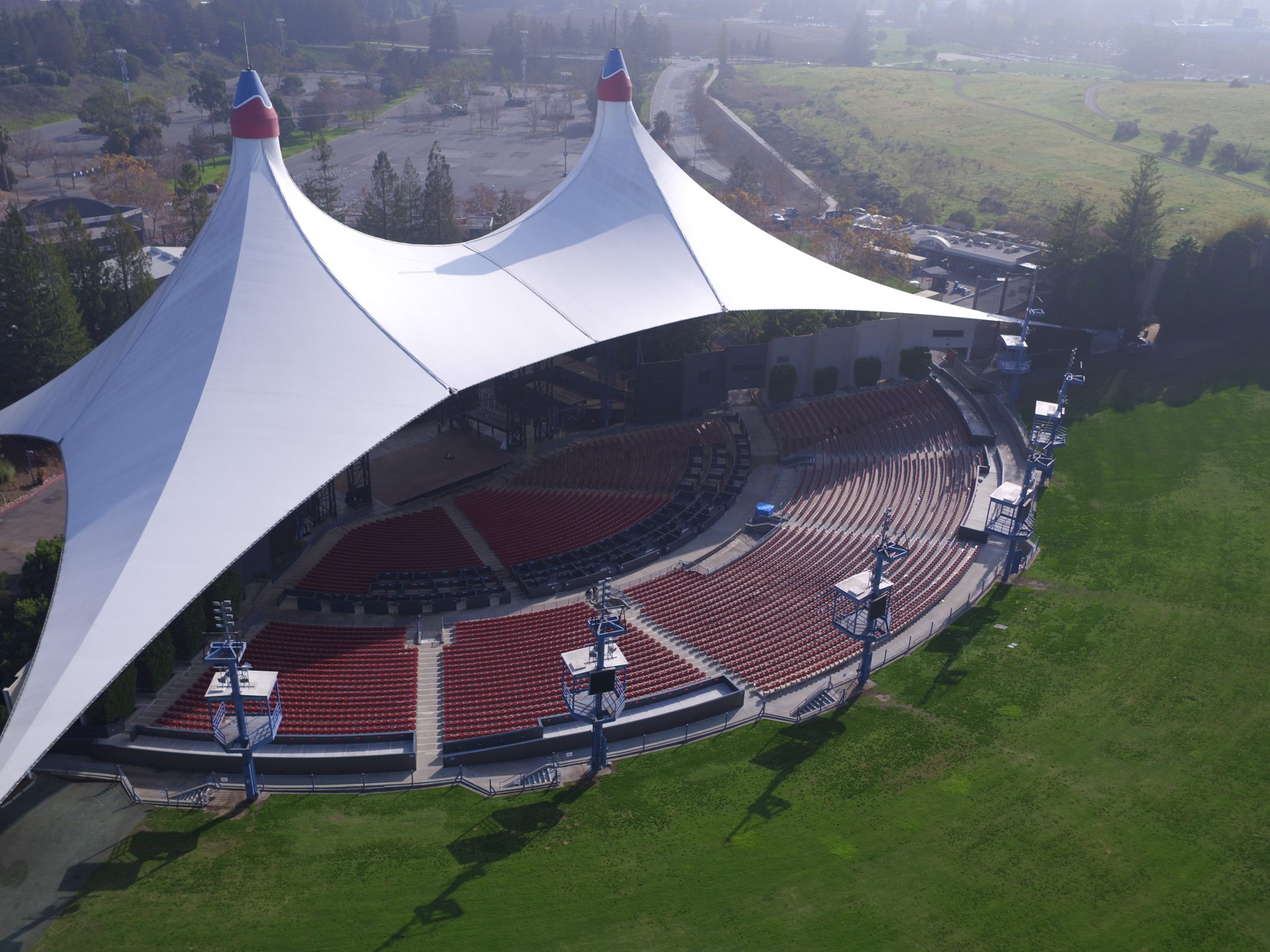
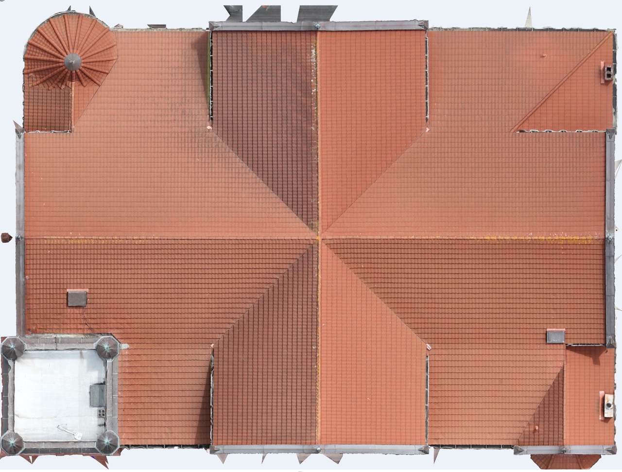
For projects demanding a higher perspective, we offer advanced drone (UAV) services, including high-resolution photogrammetry and LiDAR. This technology is ideal for safely and efficiently capturing detailed data of rooftops, large-scale sites, and hard-to-reach areas. Our expert team transforms this data into comprehensive site maps and detailed exterior models, providing you with a complete and accurate understanding of your project environment.
Non-invasive 3D scanning of the building envelope to detect deterioration, water intrusion, cracking, and movement. We deliver clear, comparative reports that prioritize repairs, support safety planning, and document compliance.
Non-invasive 3D scanning establishes a defensible baseline for historic resources and tracks change over time. Our archival-quality records align with HABS/HAER/HALS standards to guide mitigation and satisfy regulatory requirements.

Every successful project starts with a collaborative conversation. To streamline this process, we use our Survey Checklist to help define your project’s scope. This fillable document makes it easy to outline your goals, challenges, and required deliverables together, ensuring the final quote is accurate and perfectly aligned with your needs.

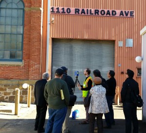
Our expert technicians arrive on-site with the right technology for the job. We systematically capture the entire project area from multiple angles, ensuring complete coverage and data redundancy. Our process is efficient and designed to minimize disruption to your ongoing operations.

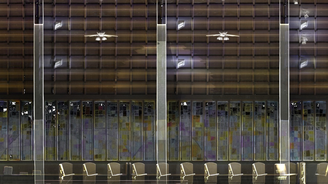
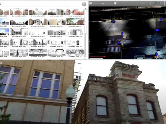
Back in the office, the raw scan data from multiple scans is registered and unified into a single, cohesive point cloud. This is a critical step where we clean the data, verify accuracy, and prepare it for modeling. This is where raw data points begin to transform into usable vector information.

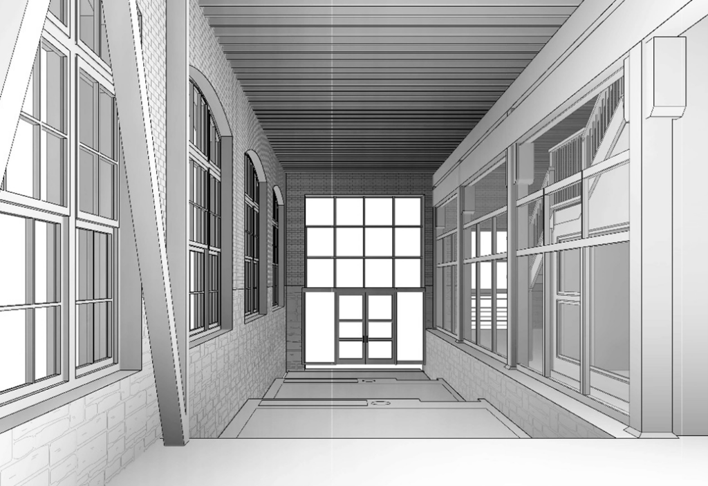
Our skilled modelers use the processed point cloud as a precise template to build your final deliverable. Whether it’s a 2D CAD file, a detailed Revit model for Scan-to-BIM, or HABS/HAER/HALS documentation, we craft the final product to your exact specifications and deliver it in the file formats your team needs.
Our 3D scanning services are designed to provide clarity at every stage of your project’s lifecycle. Whether you need to document existing conditions for a renovation, create a digital twin for facility management, or produce exacting HABS/HAER documentation for a historic site, we have the technology and expertise to deliver. Explore our core services to see how we can support your specific needs, including the handling of various types of files. We deliver output files in a range of file formats—such as STL, OBJ and CAD files—ensuring compatibility with your workflow and post‑processing requirements.
The cost of 3D scanning services is not one-size-fits-all. Pricing depends on several key factors: the size and complexity of the object or building, the required level of accuracy and detail (LOD), site conditions (e.g., accessibility, active operations), and the final deliverables needed (e.g., raw point cloud vs. a fully developed BIM model). A small, open room will cost less than a complex industrial facility with extensive MEP systems. We provide a detailed, custom quote for every project after our initial discovery and scoping call to ensure you only pay for what you need.
Modern terrestrial laser scanners are incredibly accurate, typically capturing data with a precision of +/- 2-4 millimeters. This high level of accuracy is essential for applications in construction, engineering, and historic preservation, where precise measurements are critical for avoiding clashes, ensuring proper fit, and creating a reliable digital record. The final accuracy of a project also depends on our rigorous data processing and quality control workflows, which ensure the final model is a true representation of the physical object.
LiDAR (Light Detection and Ranging) is the core technology used in most professional 3D laser scanners. It works by emitting a laser and measuring the time it takes to return, calculating a precise distance for millions of points. Photogrammetry, on the other hand, uses a series of high-resolution 2D photographs taken from different angles to computationally create a 3D model. While both are forms of reality capture, LiDAR is generally more accurate for dimensional control and as-built documentation, while photogrammetry can be excellent for capturing color and texture for visualizations. We use the best technology for the specific project requirement.
A point cloud is the direct output of a 3D scanner—a massive collection of millions or even billions of individual data points that collectively map an object’s surface in 3D space. It’s the raw digital foundation for all other deliverables. We can deliver point clouds in various industry-standard file formats, including.RCP (for Autodesk Revit/AutoCAD),.E57 (a vendor-neutral format), and.PTS. Our final models are delivered in native formats like.RVT (Revit),.DWG (AutoCAD), and.IFC (a universal BIM format), ensuring seamless integration into your existing software workflows.
Project timelines vary based on scope. The on-site scanning itself can be very fast, often completed in a day or two for a medium-sized building. The more time-intensive part is the back-office data processing and modeling. A simple as-built drawing project might take a week, while a complex, high-LOD Scan-to-BIM project could take several weeks. We establish a clear timeline during the scoping phase of every project, ensuring transparency and predictability.
Scan-to-BIM is the process of using a 3D point cloud, captured from a laser scan of a physical building, as a reference to create an accurate and intelligent Building Information Model (BIM). Instead of starting a design from scratch or from inaccurate old drawings, architects and engineers can build their digital model around a perfect representation of the real-world conditions. This is crucial for renovation and retrofit projects, as it allows for early clash detection and ensures that new designs will integrate perfectly with the existing structure.
Have questions or need guidance? Fill out the form below. Already know your scope and site details? Complete the Survey Checklist and our team will review and quote your project →