The advantages of terrestrial 3D laser scanning extend throughout a building’s lifecycle, offering benefits at various stages:
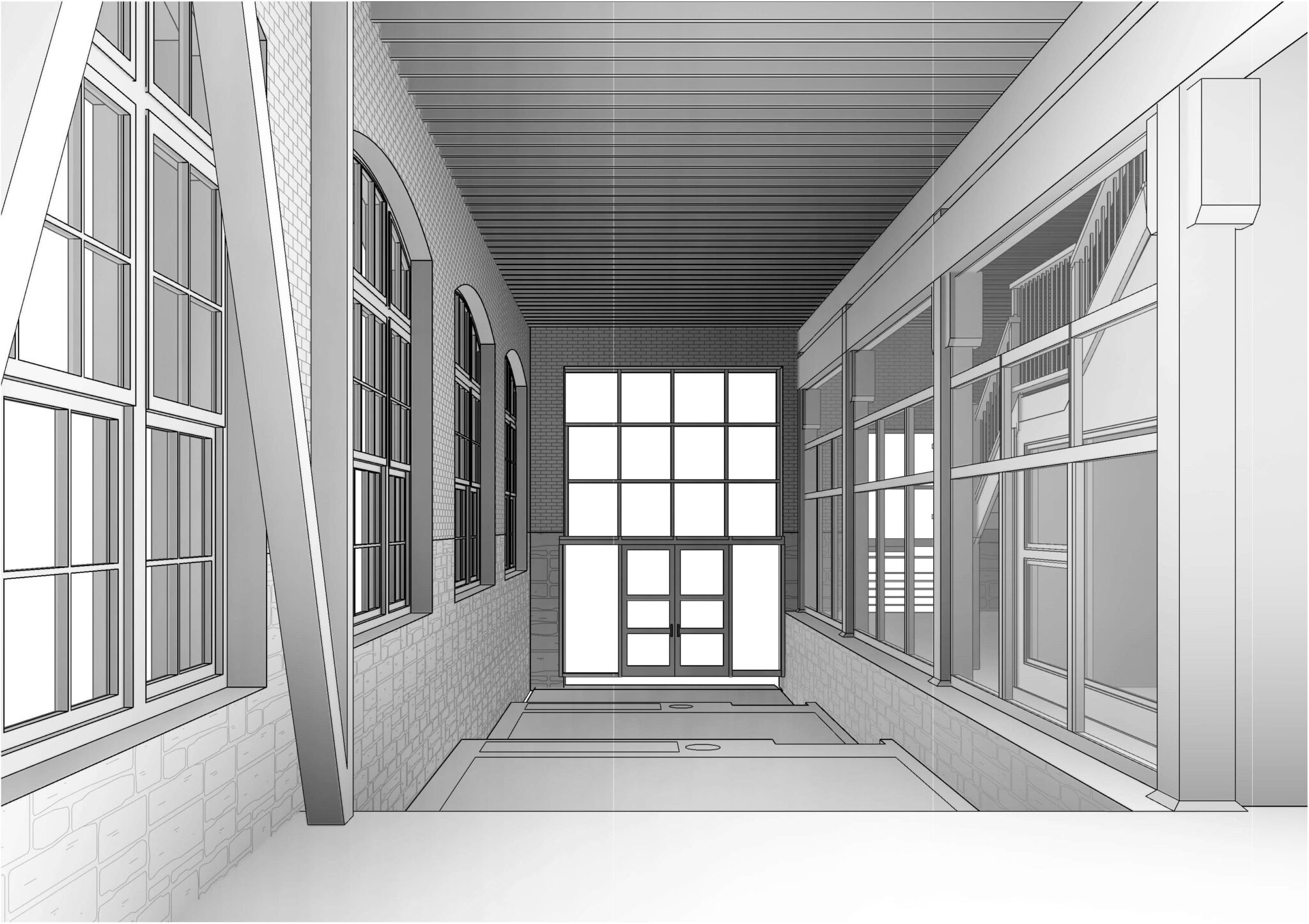
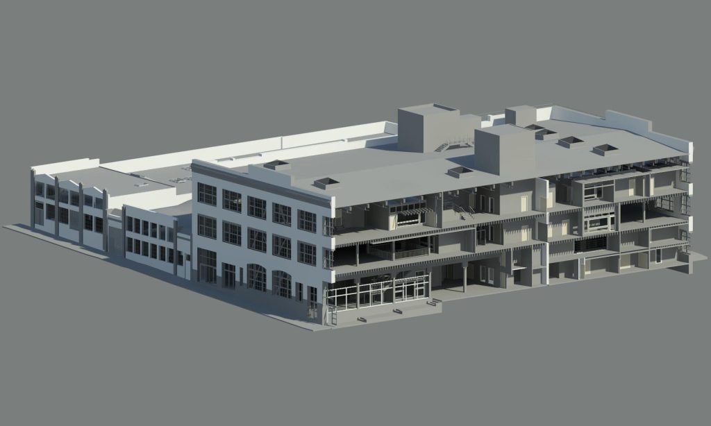
1. Accurate Documentation and Visualization: Traditional methods often fall short in accurately documenting complex structures. The technology captures millions of data points per second, resulting in a highly detailed and accurate representation of the built environment. This detailed documentation serves as a foundation for informed decision-making during the entire project lifecycle, including architectural design, structural analysis, and renovation.
2. Efficient Surveying and Data Collection: Traditional surveying methods can be time-consuming and resource intensive. In contrast, 3D laser scanning significantly reduces the time required for documenting existing conditions. Scanners can swiftly capture vast amounts of data, even in complex and hard-to-reach areas. This efficiency accelerates project timelines and increases productivity, ultimately leading to cost savings.
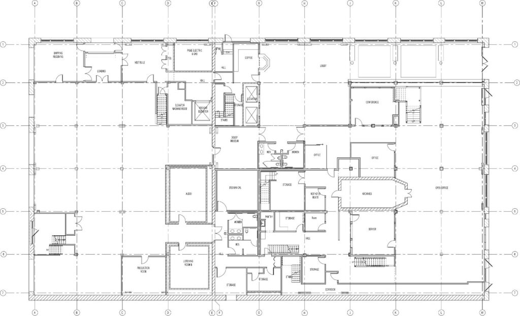
3. Enhanced Design and Planning: The accurate and comprehensive data acquired through 3D laser scanning facilitates more informed design and planning processes. Architects, engineers, and designers can work with an accurate, detailed digital model of the existing building, allowing them to identify potential clashes, design flaws, and spatial constraints before construction begins. This minimizes costly design changes during construction and enhances overall project efficiency.
4. Conflict Detection and Resolution: Terrestrial 3D laser scanning aids in detecting clashes and conflicts between various building systems, such as mechanical, electrical, and plumbing. These clashes, if left unresolved, can lead to delays, rework, and budget overruns. By identifying and resolving these issues in the digital model, project teams can mitigate risks and streamline construction operations.
5. As-Built Verification: Comparing the as-designed model with the as-built conditions is a critical aspect of quality control. Terrestrial 3D laser scanning provides an accurate means of verifying that the constructed building aligns with the intended design. This verification process aids in ensuring compliance with project specifications, codes, and regulations.
6. Historical Preservation/Conservation and Restoration: For historical buildings and structures, 3D laser scanning offers a non-intrusive method of documentation. This technology enables the creation of accurate digital replicas of cultural heritage sites, facilitating preservation efforts, restoration projects, historical research, and HABS/AHER documentation. The detailed data captured can serve as a valuable resource, archived for future generations.
7. Remote Collaboration and Communication: Once the project has been scanned, the 3D point cloud model can be easily shared and accessed remotely. With the virtual navigation capability, collaboration among project stakeholders can take place even when they are geographically dispersed. Architects, engineers, contractors, and clients can review the same data simultaneously, fostering effective communication and decision-making without having to be physically present at the project site.
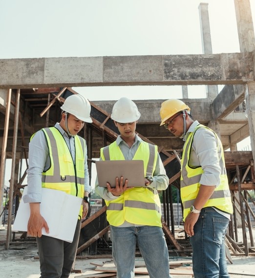
8. Risk Reduction and Safety Enhancement: By reducing the need for manual measurements and site visits, 3D laser scanning contributes to improved safety on construction sites. Workers are exposed to fewer hazards associated with traditional surveying methods, leading to fewer accidents and injuries. Moreover, accurate data aids in risk management by reducing errors that can have negative operational, economic, financial and/or legal impact.
9. Cost Savings and Time Efficiency: The benefits of terrestrial 3D laser scanning ultimately translate into substantial cost savings and time efficiency. With accurate data guiding the project from inception to completion, the likelihood of rework, change orders, and delays decreases. This streamlined process leads to optimized resource utilization and a faster return on investment.
10. Data-Driven Maintenance and Facilities Management: Beyond construction, 3D laser scanning supports ongoing building maintenance and facilities management. By creating a digital twin of the building, property managers can monitor changes, perform condition assessments, and plan maintenance activities more effectively. This proactive approach prolongs the lifespan of the structure and maximizes its operational efficiency.