REALITY CAPTURE FOR EVENT PRODUCTION PLANNING
Utilizing different 3D imaging technologies, 3DVDT delivered solutions for various tasks required by the global brand experience agency Sparks for their client, Google.
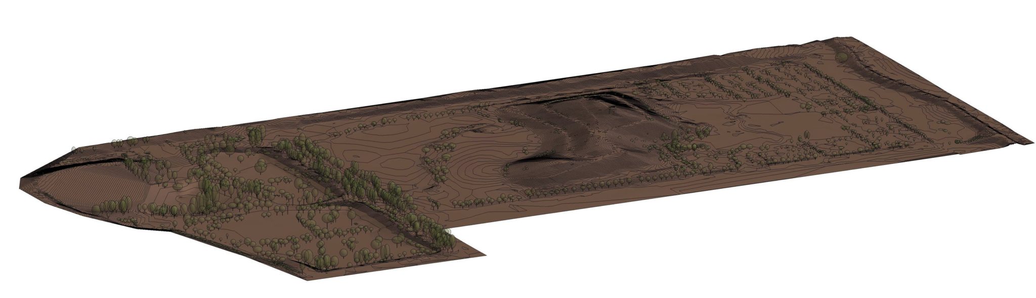
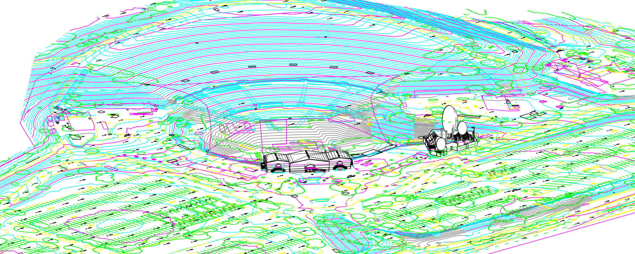
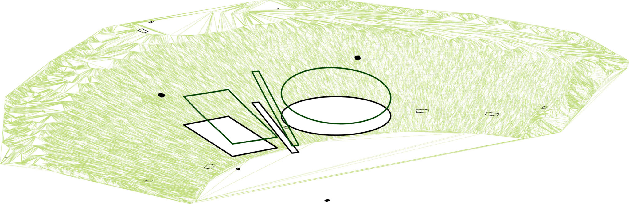
Aerial mapping services included image acquisition with the use of an unmanned aerial vehicle (aka drone). Ground survey control and map production were provided to support 3D modeling as well as topographic and planimetric mapping of the parking lot areas for event planning purposes.
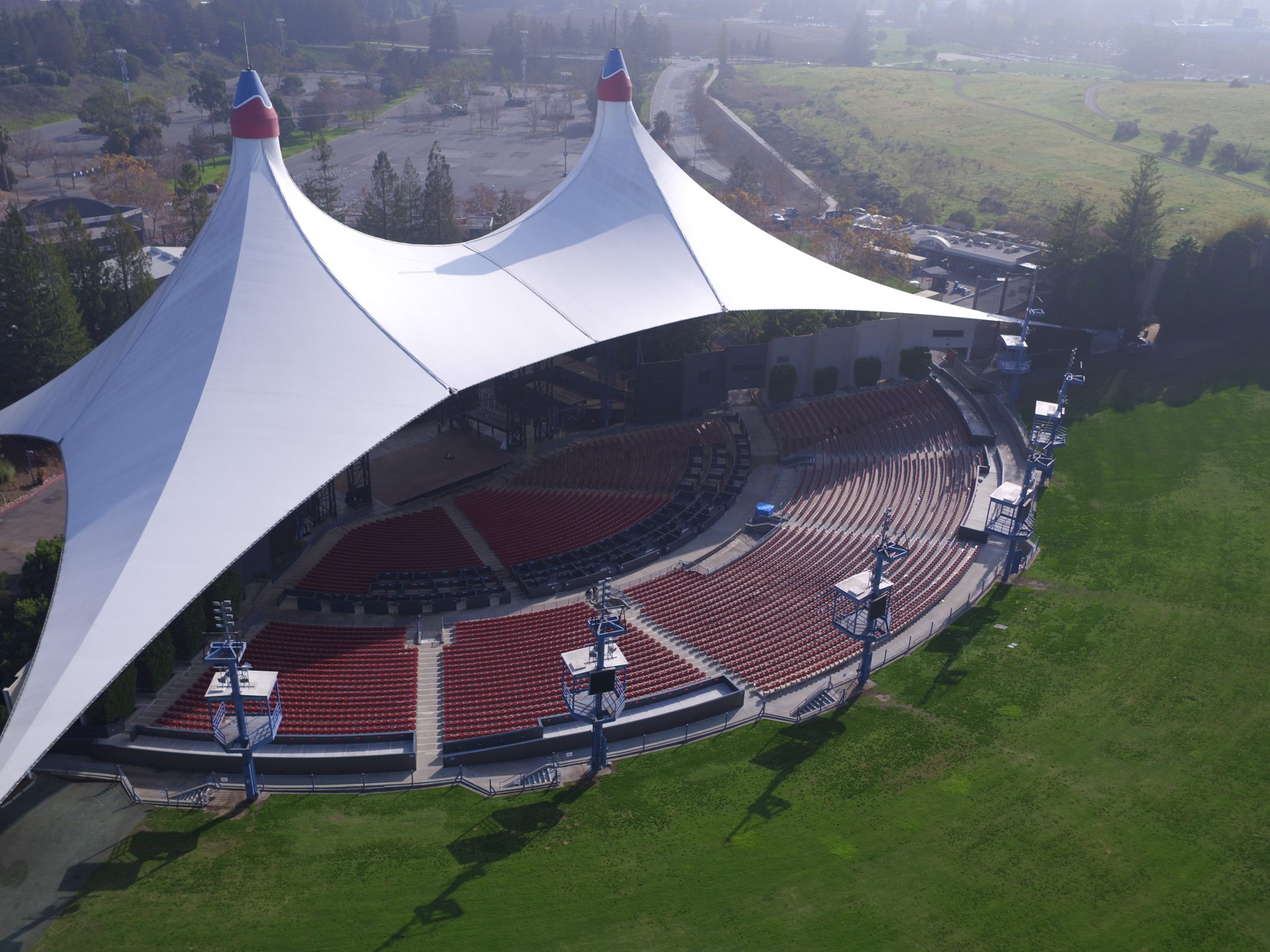
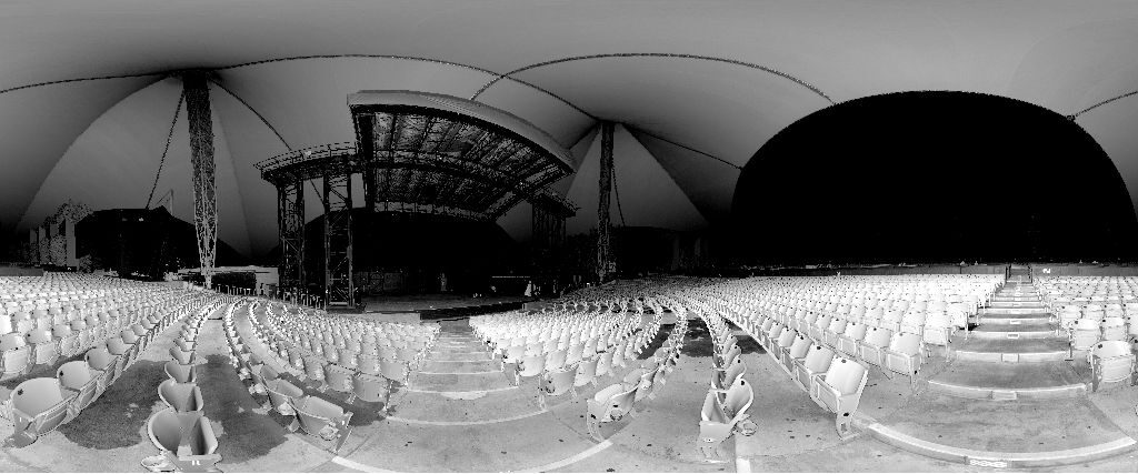
Terrestrial 3D laser scanning was used to capture the buildings and areas that were utilized for the event. 3D models of the buildings and parking lots were created for space and logistics planning.
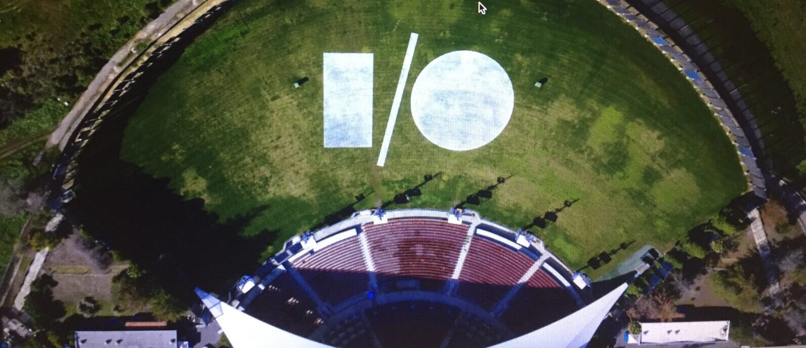
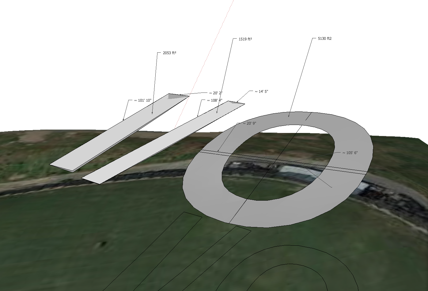
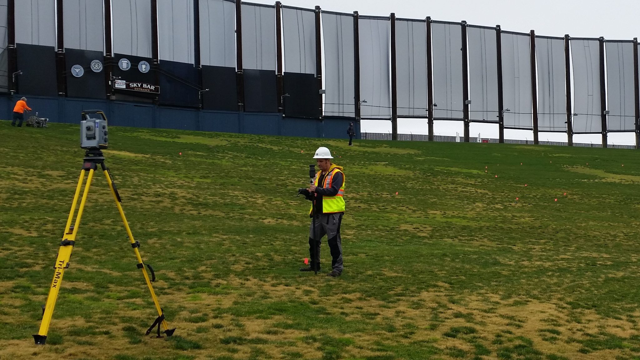
As part of the marketing for the Google IO Event, the logo was projected onto the amphitheater hillside. Using the site model, the coordinates of the logo were staked onto the ground using a robotic total station. Then, the approximately 85 ft. x 110 ft. overall logo was filled in using gallons of athletic field paint.
Shortly thereafter, the helicopter took to the sky to take an aerial photo that was used on the event invitation.